
Town of Rye ZIP Code Coverage
The Town of Rye ZIP code directory is a postal reference, not a resident roll or a map of legal jurisdiction. The records geography has three recurring address patterns: Port Chester and Rye Brook labels, a Mamaroneck label in Rye Neck, and the separate City of Rye label that must be excluded. Use the full address and legal municipality with the ZIP before opening a property, court, or Town record. A ZIP alone can narrow a question, but it cannot establish which government holds the record.
| ZIP Code | Areas Covered | Post Office Label | Research Note |
|---|---|---|---|
| 10573 | Port Chester and Rye Brook postal addresses | Port Chester postal city, with Rye Brook addresses also used | Postal label is not a legal Town boundary |
| 10543 | Mamaroneck postal addresses in the Rye Neck portion of the Town | Mamaroneck postal label | Check the individual address because Village, Town, and postal labels differ |
| 10580 | Independent City of Rye postal geography | City of Rye postal geography | Do not blend it into the Town of Rye target |
These are the documented labels used to keep the Town target distinct. No official USPS municipal coverage list or ZIP-boundary map was found in the research. The Postal Service confirms the delivery ZIP for an address, while a Town, village, deed, or parcel source resolves government jurisdiction.
Note: Postal labels are delivery information and should be recorded beside, not instead of, the legal municipality.
Town of Rye Postal Geography
The Town is not a compact shape. It became noncontiguous when the City of Rye became independent in 1942. Today's Town includes the Village of Port Chester, the Village of Rye Brook, and the Rye Neck portion of the Village of Mamaroneck. A reference to "Rye" can therefore mean the Town, the independent City, a village within the Town, or a postal label. Record notes should preserve each of those labels instead of replacing one with another.
This is the geographic quirk behind most ZIP misunderstandings. A Rye Brook address may use Port Chester as its postal city, while a Rye Neck address can use Mamaroneck. The Town of Rye ZIP code directory keeps those labels visible so a searcher does not send a Town question to City of Rye offices or treat a postal city as a municipal answer.
The Census geography table distinguishes Rye town from Rye city, the same separation that should be retained in a ZIP-based record search.
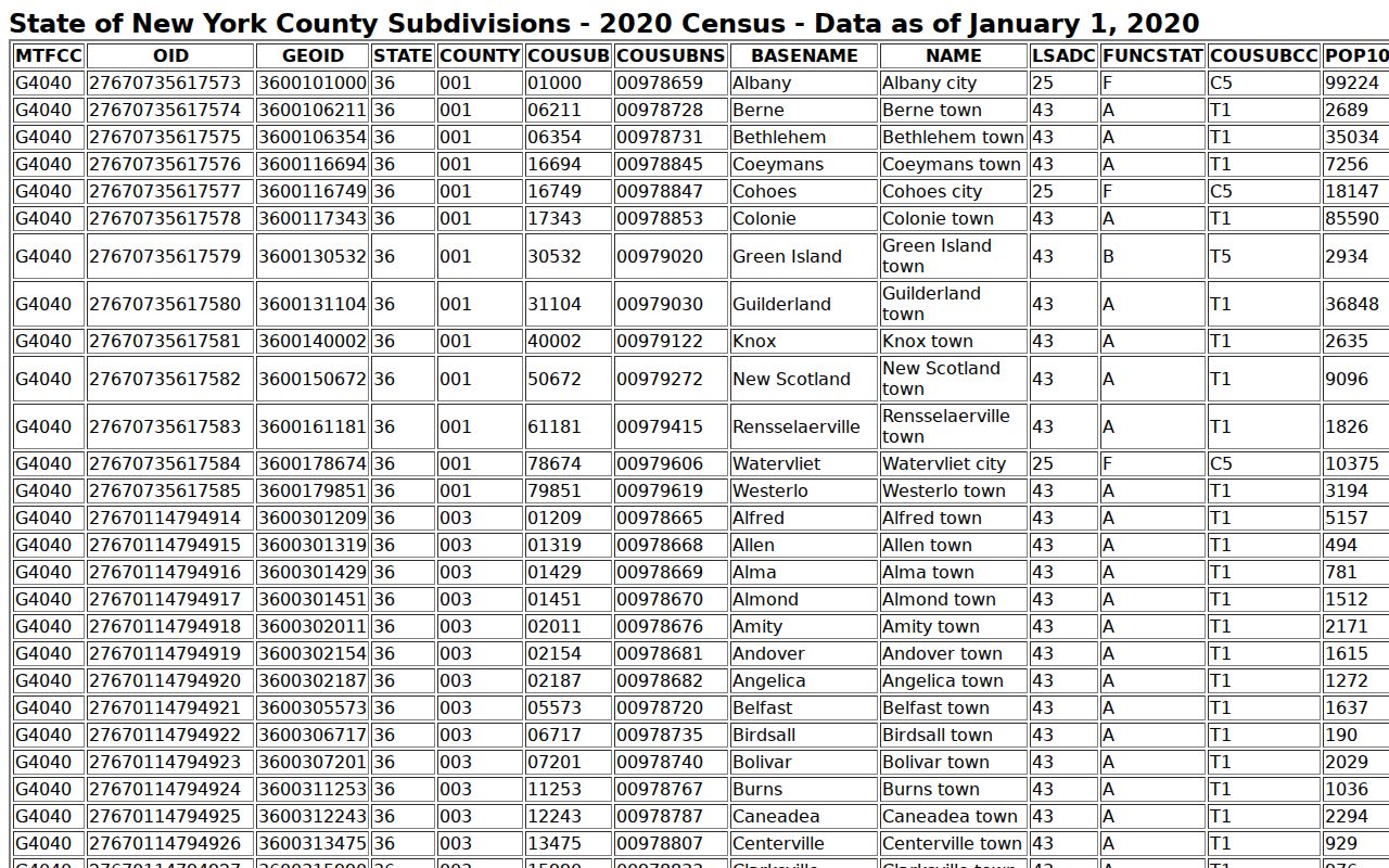
The Census label is a useful jurisdiction check, but it does not replace the Postal Service's delivery verification for a particular address.
Town of Rye 10573 ZIP Code
Postal code 10573 appears with both Port Chester and Rye Brook postal addresses. That overlap is expected in the Town's records geography. It is not evidence that Port Chester and Rye Brook are the same legal municipality, and it does not create a Town-wide list of people using the code. Write the postal city exactly as supplied for delivery, then add the village and Town jurisdiction from the underlying address or parcel record.
For a property question, the Town's PROS Property Data Search works by owner, street address, SBL, or Street Finder, not by ZIP-wide browsing. Once an address is confirmed, PROS can provide the parcel trail. A current owner or owner mailing address is still different from the person who may occupy the location. The code helps organize addresses, not prove residence.
Town of Rye 10543 ZIP Code
Postal code 10543 is the Mamaroneck label that can appear in the Town's Rye Neck area. It deserves a separate note because the address can look like it belongs to a different government even when the location is part of Town of Rye research geography. Confirm the legal municipality before selecting an assessor, clerk, court, or local registrar route.
The distinction matters most for vital events and property records. Custody can depend on the place of event, while the parcel system tracks a location through an SBL and municipality fields. A mailing label should remain a mailing label until the Town, village, and record custodian are independently verified. That restraint keeps the Town of Rye ZIP code directory from overstating what 10543 tells a reader.
Note: A full street address is more useful than a ZIP alone when a record must be tied to the correct Rye Neck jurisdiction.
City of Rye 10580
ZIP code 10580 belongs to the independent City of Rye, not the Town target. The City separated from the Town in 1942, and it has its own government records context. Excluding 10580 is not a claim that the City is unrelated to regional history. It is a record-scope rule: do not silently mix City of Rye results into a Town of Rye ZIP code directory or use a City label as evidence for a Town parcel, court matter, or vital route.
When an address is near the Town and City line, keep a separate column for legal municipality and another for postal code. The Census geography source distinguishes the two, and an assessor or deed source can supply the property jurisdiction. That two-field check is safer than searching every result containing the word Rye.
Note: A City of Rye result may be regionally relevant, but it is outside the Town of Rye records target.
Town of Rye ZIP Verification
There is no confirmed ZIP-wide resident roster in the Town property system, and the right workflow is address-first. The USPS ZIP Lookup asks for a street address, city, and state to verify the delivery ZIP for that address. It does not issue a legal-boundary opinion. Save the delivery result beside the municipality, then use a parcel or clerk source for the legal record question.
- Write the full address exactly, including its postal city, then verify the delivery ZIP with the USPS address lookup.
- Check whether the location falls in Port Chester, Rye Brook, or the Rye Neck portion of Mamaroneck, and keep the independent City of Rye separate.
- Open the Town property record or County parcel data by address or SBL to identify the government parcel trail.
- Use the postal result only to organize the next address search. For a street-by-street records chain, move to the Town of Rye street directory.
The workflow supports an address question without implying that a ZIP can reveal all residents who receive mail under that code.
Town of Rye GIS ZIP Fields
The Westchester County Town of Rye parcel query layer makes an important split visible. It exposes property-address components and owner-mailing components as separate fields. The code attached to a parcel's situs address can differ from the code attached to an owner's mailing address. That is a useful records distinction, but neither field is a verified roster of people living at the parcel.
| Field | What It Describes | How to Read It |
|---|---|---|
| PROPZIP | ZIP component of the property or situs address | Use for the location's postal context |
| OWNERZIP | ZIP component of the owner mailing address | Do not confuse with the property's ZIP or occupancy |
| SBL | Section, block, and lot parcel identifier | Carry it between assessor, GIS, and deed research |
| PROPADDRESS and PROPCITY | Property street and city components | Compare with the legal municipality before choosing a custodian |
The County says its municipal parcel boundaries are approximate. Use the GIS layer to locate and compare a parcel, then rely on a deed for the legal description.
Town of Rye Voter Lookup Limits
New York's Poll Site Search and Voter Registration Lookup has a ZIP field, but it is a self-lookup refinement, not a ZIP-wide voter browser. The tool asks for county, last name, first name, date of birth, address, ZIP, and Search. It helps a registered voter check their own registration or poll-site information. It does not provide a way to enter 10573 or 10543 and browse all voters associated with that postal code.
| Lookup Field | Role | ZIP Limitation |
|---|---|---|
| County | Selects the county context | Westchester does not turn the tool into a public roster |
| Name and date of birth | Identifies the individual voter | Required identifying information is central to the tool |
| Address | Checks the individual's registration details | Not a street or postal-code browsing control |
| ZIP Code | Refines an individual address search | Cannot return a ZIP-wide voter list |
Voter registration records have separate public-access rules. A statewide or multidistrict voter-file request through the Board of Elections requires an election-purpose statement under Election Law section 3-103. That route is purpose-restricted and should not be presented as a ZIP resident directory.
Note: Do not treat a self-service voter result or a purpose-restricted request as a postal-code directory.
Town of Rye Parcel Research
For legal parcel research, use the SBL and deed legal description rather than a ZIP. An SBL is the section, block, and lot identifier that links the Town assessment record, County GIS layer, and land-record trail. A street address, owner mailing address, and legal description may use different wording. The parcel identifier is the more stable bridge when an old map, a postal label, or a nearby municipality creates uncertainty.
Westchester County's land-record gateway is the next step when the question is ownership or an older transfer, but the online system has registration and remote-access boundaries. Its public office route remains the fallback for access questions. Use the ZIP only as one note in the chain, never as the legal key that controls a deed search.
Town of Rye ZIP Boundaries
Postal zones, Census geography, Town boundaries, and parcel lines are different systems. That is why a Town of Rye ZIP code directory must stop short of declaring every address under a given postal label to be inside the Town. Store legal municipality, village, county, state, ZIP, and situs address as separate facts. For population research, use a source that expressly labels the subject as Rye town rather than Rye city.
Boundary check. USPS verifies delivery for an address, while a deed and jurisdictional parcel record answer the legal-location question. Neither a postal city nor an owner mailing ZIP proves Town inclusion or current occupancy.
- ZIP and ZIP+4
- A ZIP identifies a postal delivery area. ZIP+4 adds delivery detail and does not establish a Town boundary.
- PO Box ZIP
- A ZIP used for post-office-box delivery. No Town of Rye PO Box ZIP was verified in the research.
- Unique ZIP
- A postal code assigned to a single recipient or organization. No such Town assignment was verified in the research.
- Carrier route
- A postal delivery grouping. It is not a legal municipality or parcel boundary.