
Walk a Town of Rye Street
A useful Town of Rye street directory begins with a real street address and ends with a careful distinction between an ownership record and a household claim. The Town Assessor’s parcel systems are the best starting point because they join a location to a section, block, and lot identifier, also called an SBL. That identifier is more stable than a street label when an older deed uses a subdivision or lot description. The public trail can show parcel ownership and recorded transfers. It does not make a complete roll of everyone at each address.
- Enter the address in the Town’s PROS property search, or use Street Finder to browse one public road. Note the parcel’s SBL and the owner and mailing-address fields without treating the mailing address as the property address.
- Open the same location in AxisGIS. Click the parcel, check the road spelling, and use nearby polygons only to orient the street-by-street review.
- Use the SBL and current owner to begin a Westchester land-record search. A deed records a title event and parties to it, rather than every person living there.
- Work backward from the current owner as grantee to the seller as an earlier grantee. Compare the legal description, municipality, and SBL at every turn.
- For a past household question, ask the Port Chester-Rye Brook reference desk whether it holds a relevant reverse or criss-cross volume. Exact local runs are not confirmed online.
New York’s voter tool is not a public street roster. It is a self-lookup that requires a person’s identifying information, and statewide voter-file requests have an election-purpose restriction. Keep it separate from parcel and deed research.
Town of Rye Street Directory in PROS
The Town of Rye PROS Quick Search accepts Street Address, Tax Map #/SBL, Owner Name, and Street Finder. Street Address uses a contains match, so a partial entry can return a longer address. Street Finder is the safer route for reviewing a whole road, with or without an address number. Owner searching accepts a last name, and the documented =Williams form requests an exact last-name match. Treat that search as a parcel index, not a list of occupants.
| PROS field | Use on a street search | Search note |
|---|---|---|
| Street Address | Find a known property | Contains match; a partial address can return a longer street form. |
| Tax Map # / SBL | Carry one parcel across records | Use the identifier from an assessment or tax record. |
| Owner Name | Locate a current or prior owner record | Last name works; =Williams is the documented exact-surname form. |
| Street Finder | Browse a public Town road | Best whole-road starting point; it can combine a road and number. |
The PROS advanced search adds street name, owner, neighborhood, property class, sale date and price, year built, assessed values, and physical characteristics. Those filters can narrow a set of parcels, but they do not turn assessment inventory into proof of who occupies a property.
The advanced-search screen is shown below with its address, sale, assessment, neighborhood, and property-detail filters.
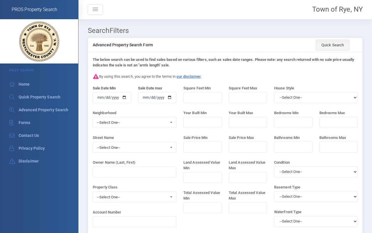
Use the result as a research worksheet: keep the street form, SBL, assessment year, and any sale detail together before moving to another source.
Map a Town of Rye Street in AxisGIS
Town of Rye AxisGIS searches by owner, address, or Parcel ID/SBL. Its map-first view lets a researcher click a parcel, inspect the surrounding polygons, turn on layers, measure, and print an individual tax map. Available layer controls include items such as contour, community facilities, FEMA flood, sewer, school, water-district, and fire-district information. Those layers provide context for a street, not a legal boundary decision.
The AxisGIS parcel viewer is the practical map companion to the property search.
Record each parcel’s SBL before comparing names. County parcel geometry is approximate, so a deed or survey, not a screen line, controls a legal boundary question.
Town of Rye Address Records by Street
Address-keyed sources each answer a narrower question. PROS and annual rolls connect a parcel to assessment information. GIS adds map context and distinguishes the property address from an owner’s mailing address. WRO supplies recorded title events. The Town has not published a searchable permit or code index, so an address-specific records request is the fallback for existing files. The library and newspaper archive add historical leads, but neither should be presented as a complete current street directory.
| Address-keyed source | What it can establish | Access route |
|---|---|---|
| PROS property data | Parcel, owner, mailing address, values, exemptions, inventory, historic-card and map leads | Town public search |
| AxisGIS and County GIS | SBL, situs fields, owner mailing fields, districts, and approximate parcel geometry | Public map and county service |
| Assessment-roll PDFs | Annual parcel, owner, value, and exemption snapshots | Town roll archive |
| Westchester Records Online | Recorded transfers, parties, legal descriptions, and land-record index leads | Account-protected remote service; County Clerk fallback |
| Town permit or code file | Existing address, date, permit-number, or inspection material if retained | Precise Town FOIL request; no public index located |
| Library and newspaper sources | Historic address references, notices, and possible directory leads | Reference desk and searchable newspaper archive |
The chain is address to SBL, SBL to a recorded description, and then a dated title event. That sequence reduces errors caused by similar road names, postal labels, and changes in the way a deed describes land.
Town of Rye Address Record Terms
One parcel can carry several valid address descriptions. Westchester County’s parcel schema separates PROPADDRESS and PROPZIP from OWNERADDRESS and OWNERZIP. The first pair describes the property, also called the situs. The second is an owner mailing field and may lead to a post-office box, an agent, or another property. The deed’s legal description can use lots, blocks, or subdivision language instead of the familiar street address.
- Parcel or SBL
- The section, block, and lot identifier used to carry one property across Town assessment records, maps, and deeds.
- Situs address
- The physical property location in the assessment or GIS record, distinct from an owner mailing address.
- Legal description
- The deed language that identifies the land, often through lot, block, subdivision, or other recorded terms.
- Criss-cross directory
- An address-ordered directory format that may connect a street to a historical household entry when a local volume exists.
These distinctions matter across the Town’s noncontiguous geography. A Port Chester, Rye Brook, Mamaroneck, or Rye label can point to different municipal or postal contexts, so retain the address exactly as the record gives it.
Town of Rye Annual Roll Snapshots
The Town’s assessment-roll archive visibly lists final PDFs for 2010 through 2025 and a 2026 tentative roll. A roll is a dated assessment snapshot, useful when a street-level question depends on the year rather than today’s property card. The Town says each roll lists parcel identifiers, owner and property-address fields, owner mailing address, assessed value, and exemptions.
The Town assessment-roll page identifies the annual PDF route and roll timing.
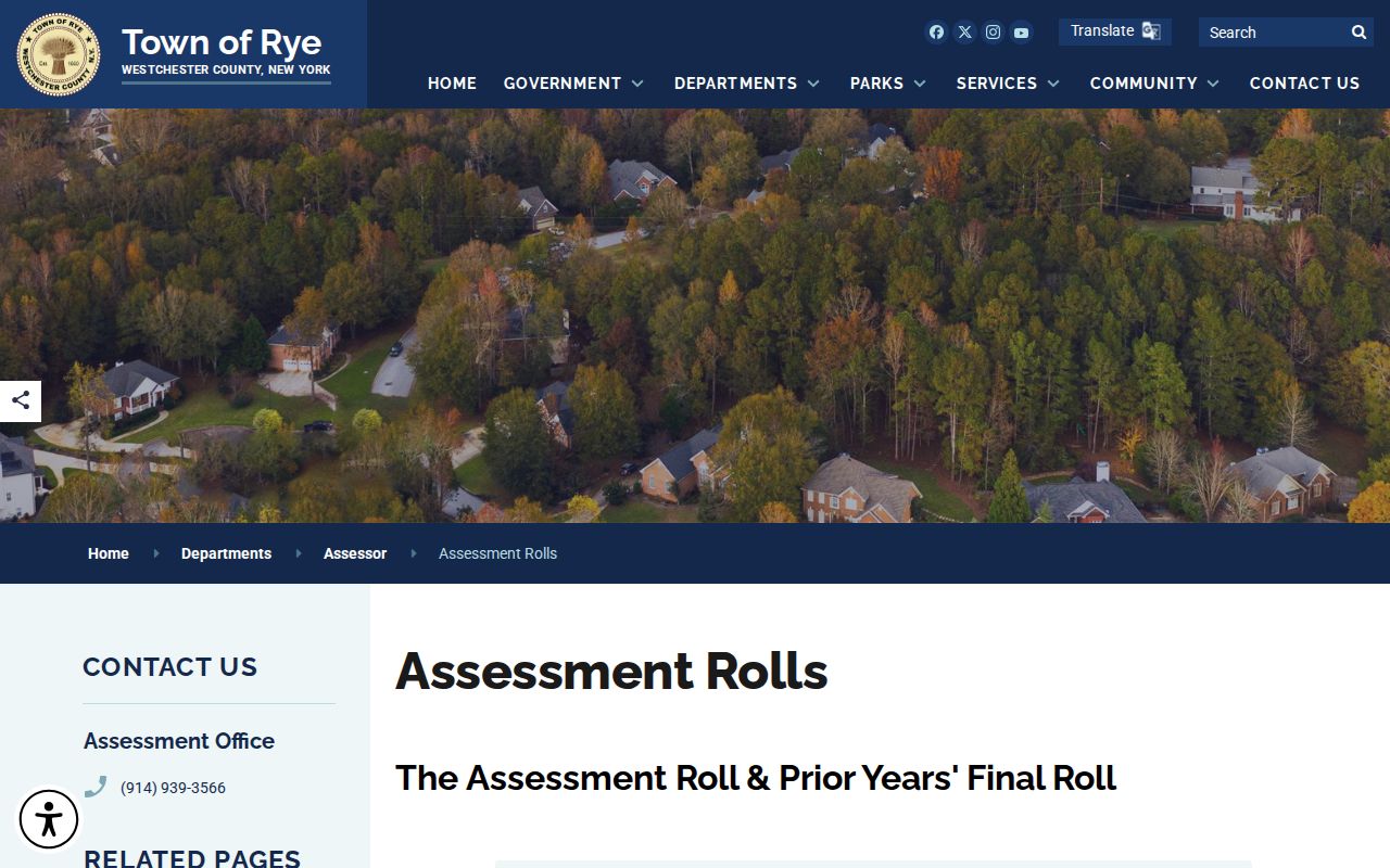
PDF search tips differ from the live parcel tools: use a last name or street number plus the first four street letters, omit a suffix, and omit a directional prefix when searching the PDF.
Town of Rye Street Directory Prefix Quirk
A local search can fail because two official routes handle directional words differently. In PROS and AxisGIS, street forms such as N. Main and E. Boston Post need their directional prefixes. Omitting N., S., E., or W. may miss a result. The PDF roll instructions use the opposite shorthand, telling researchers to omit directions and suffixes when using browser search.
Run both forms only in their proper setting. The mismatch is not evidence that a parcel disappeared. It is a Town of Rye street-directory search quirk, and the SBL is the best way to confirm that two result sets refer to the same property.
Note: Keep the source, search form, and assessment year beside every street result so a later review can reproduce the match.
Town of Rye Street Deed Trail
Westchester Records Online, known as WRO, advertises land records from the eighteenth century to current records. The interface is protected: registration is required to view images immediately, and the remote-access terms describe paid licensed access. The crawler could not verify every live grantor-grantee field or the exact image cutover, so a precise index or image claim should be checked in the portal or with the County Clerk’s Land Records Division.
For an address trail, search the current owner as grantee, identify the acquisition instrument, then take its seller or grantor backward as an earlier grantee. Compare SBL, legal description, municipality, and lot language each time. A deed may show a recorded transfer and its parties, but it does not establish that each named party lived at the parcel.
Town of Rye Street Permit Requests
Town Building and Zoning links exist, but research did not locate a public Town index for permits or code cases. When a dated address file is needed, use the Town’s FOIL procedure to request an existing record. Describe the street address, the date range, and a permit number if one is known. A tight request helps the custodian locate a file without being asked to create a new list or conduct research.
FOIL is a fallback, not a substitute for the SBL and land-record chain. It can help locate retained address material, while the result and any withheld information remain subject to the Town’s records rules and applicable exemptions.
Town of Rye Streets Before Digital Maps
The Town’s property-record gateway links the current assessment routes, tax maps, GIS, and related tools. For older parcel evidence, the NYS Archives finding aid for series A4545 describes Rye property cards and assessment rolls from 1860 to 1990 on 170 microfilm rolls. That is an archival lead, not a promise that every card is online. Historic place labels such as Sawpits, Lyon’s Point, Boston Post, Purchase, Clamtown, and Milton Point may need to be reconciled with a modern SBL.
The Town property-record page shows the official gateway for the current address and map sources.
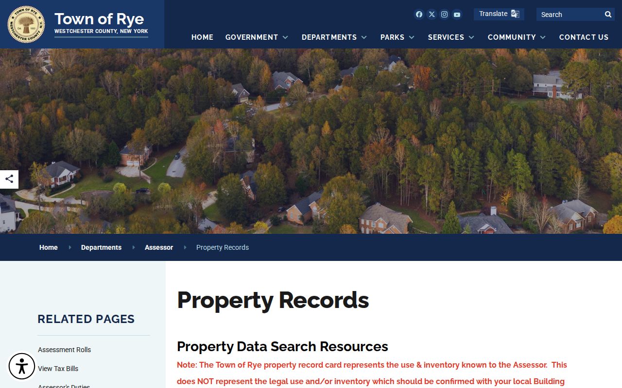
For an older household question, ask the library for any confirmed reverse or criss-cross volume and pair it with dated assessment, deed, or newspaper evidence. The historical collections themselves are treated in the Town of Rye city directory collections.
Limits of a Town of Rye Street Directory
Property cards show assessor inventory and use information, not a legal determination, and they do not list every person at an address. A public parcel map does not identify nonowner occupants. DMV and utility customer addresses are not public street-search sources. The New York voter self-lookup is for an individual registration and poll-site check, not a browser for a road. A full voter-file request has a restricted elections purpose.
Lawful use. Use Town of Rye address records for personal, lawful research and civic or family-history questions. Do not use them to stalk, harass, intimidate, or harm anyone.
Keep conclusions narrow: an assessment record can support ownership or a parcel link, a deed can support a recorded transaction, and a historical directory can provide a dated entry. None alone proves a full household or current presence.